GIS & GPS Field Services for Asset Management
Texian Geospatial is your partner in the field with GPS and Inventory solutions that will benefit your entire organization - from well locations through metering, flush valves, and storage to pipeline or capital improvements management we have Solutions.
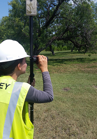
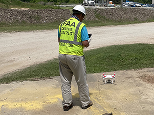
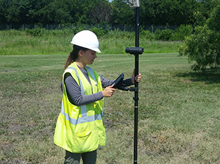
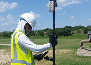
Texian Geospatial uses Eos GNSS Receivers in the field. In each project we incorporate your database schema directly into our field collection workflows providing the same attribute fields, domains and controls as your Enterprise database.
What are ArcGIS Solutions?
Solutions are a preformatted templates, compatible with Esri ArcGIS software, which provide a functioning schema for your data. Solutions are designed to leverage your data and provide new insights through dashboards and collaborative design.
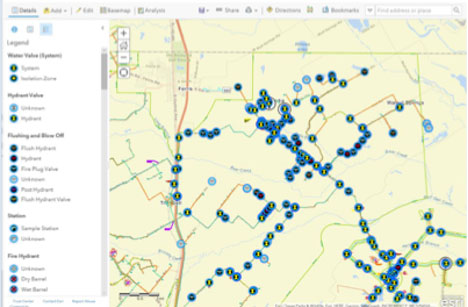
Distribution Systems
- Asset Data Inventory - GPS and attribution of system-wide assets
- Maintenance Inspections - Solutions that provide mobile connectivity for tracking and management of remote maintenance activities.
Asset Inventory and Management
- GPS Asset Inventory – Use GPS to collect geo-location and attributes of power and light poles, signs, transmission lines, transformers, meters, valves and other features as identified by the client.
- Regulatory Compliance - Our GPS Inventory services provide an accurate and detailed accounting of all of your remote fixed assets.
- Tree Surveys – Use GPS to collect geo-location of trees and other landscape features. Data capture includes: feature type, size, condition, trenching buffers, and other pertinent information.
- Field Solutions – GPS Inventory Field Services and Integrated GIS mobility from the office out to the field and back.
Asset Location and Inventory ultimately allow our customers to use the captured GPS data as a powerful tool in their corporate GIS toolbox for project and capital management. Whether Capital Improvements are being considered for replacement of old problematic facilities or construction of new ones are being planned for growth, knowing all you can about your fixed assets and their locations goes a long way in mitigating potential risks and costly expenditures associated with construction delays and other progress hindering events.
With Texian Geospatial on your team it means you will have confidence in your data and map products. Our team of GIS, GPS and Environmental professionals excel at delivering maps and data that allow our customers to apply their best management practices and optimize their profit to loss ratio. All of our map products are reproducible and can be updated with new field data, external data and reset for alternate routes. In addition, each map feature can be updated as you integrate more information into your Database.
Mobile Mapping Solutions
If mobile customization is needed, Texian Geospatial will develop a mobile solution that is cost efficient and reliable providing your Inspectors and Managers up to date inspection results. Using tablets, mobile phones, or other field technology, we are able to provide inspectors the information they need in the field. Customer need drives our development process from concept to implementation.