About Texian Geospatial GIS Mapping
Texian Geospatial and Asset Solutions, LLC. is a privately owned consulting firm based in San Marcos, Texas. Founded in 2012, Texian Geospatial specializes in a wide spectrum of IT, GIS and GPS services for asset management in municipal utilities, oil & gas, pipeline operators and environmental markets.
We are a small company, big on experience with very competitive rates and highly qualified professional staff. We take pride in our ability to provide personal attention with our small town approach to doing business.
Our Mission
Our mission is to use the power of Geospatial Analysis to provide solutions to our clients that improve efficiency, reduce costs, and improve quality. Through the application of experience, sound principles, and hard work, Texian Geospatial will meet the client’s needs with quality products and professional service.
Expertise
Since 2012, Texian Geospatial has provided high quality professional GIS and GPS services to our clients throughout Texas and the Gulf Coast States. Although we are rooted in the heart of Central Texas, we serve both foreign and domestic clients with comprehensive Geospatial services for various application and usage.
Our core staff has more than 65 years of combined experience in program and project management for Geographic Information Systems (GIS) and Global Positioning Systems (GPS). We offer true professionalism in implementing the latest GIS and GPS solutions. Over the past 10 years, IT, GIS and GPS hardware and associated software application usage and capabilities have advanced rapidly. Spatial Analysis, Mobile Computing and Real Time Data access have become a way of life for many organizations as a result. Through this incredible growth and expansion, location based products and reliable datasets have rapidly become the high demand required tools for remote and office based professionals. Whether the task is technical analysis of well or reservoir data, maintenance planning for pipeline assets, planning for capital improvements for facilities, or mapping field service areas, without good reliable Geospatial data and associated attribute information for the assets which you are planning for, you will be wasting valuable time and throwing money in the wind. If you are finding that your assets are not where you thought they were and your Geospatial data products are out of date, incomplete, or your assets are just not where they are supposed to be according to your maps, You Definitely Need Our Help! We are here to assist with or to take on the inventory, maintenance, and update of your fixed asset database.
Texian Geospatial has extensive experience in the application and management of IT, GIS and GPS data management and collection projects. Through years of work in private business, with State and municipal agencies, our team has implemented and utilized Enterprise GIS and GPS technologies and has extensive experience in developing successful workflows for keeping your data tuned. Our many years of experience with Geospatial technology, the wide range of applications and various industries we have served, and the reliable professional services that we provide allows Texian Geospatial to assess your Geospatial and Asset management challenges and work directly with you to efficiently meet the needs and goals of your management team.
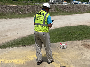
Texian Geospatial is rapidly establishing itself as a leader in Geospatial data development services, GPS field collection services, and Enterprise GIS implementation services. Our approach is to become part of our client’s GIS team and work closely with the people who will be using the data. It’s much easier to take ownership of your project when you are included in the entire process for planning and development of the scope for the solution. Our team of professionals will be there to assist from planning and implementation through to maintenance and analysis. When you hire Texian Geospatial, Our team is Your Team!
